Moderate earthquake detected near New Zealand claimed Balleny Islands in the Ross Dependency
A magnitude 5.2 earthquake was recorded in the remote Balleny Islands region on 30 September 2026. The event, detected by international seismic networks, occurred beneath the Southern Ocean in a sector claimed by New Zealand as part of the Ross Dependency. No damage or tsunami threat has been reported.
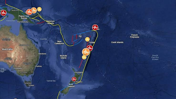
A magnitude 5.2 earthquake occurred on 30 September 2026 beneath the Southern Ocean in the Balleny Islands region, a cluster of uninhabited islands within the Ross Dependency, a sector long claimed by New Zealand. Seismic agencies registered the event early on Wednesday coordinated universal time, and researchers say the location and depth mean the quake was unlikely to affect people or infrastructure. The quake was registered by international seismic networks. The GFZ German Research Centre for Geosciences located the origin at 04:48 UTC on 30 September 2026, with its automatic bulletin listing the Balleny Islands region as the epicentral area. The event was subsequently recorded by other monitoring agencies and earthquake catalogues that track seismicity across the Southern Ocean. Seismic details and what they mean Seismological analyses indicate the event had a moment magnitude near 5.2 and occurred at a shallow crustal depth of about 10 kilometers. Quakes of this magnitude in oceanic or marginal sea settings are common and typically cause limited local shaking. In the Balleny Islands region there are no permanent settlements, and the islands are ice covered much of the year, so there was no immediate risk to residents. Because the epicenter lies in a remote part of the Southern Ocean, monitoring agencies said there were no immediate reports of damage. When earthquakes are located far from populated coastlines, the principal concerns are whether they will trigger underwater landslides or generate tsunami waves that could travel to distant shores. For this event, catalogues and early bulletins did not issue tsunami warnings, and no anomalous sea level readings or advisories were reported by tsunami monitoring centres in the hours after the quake. Why the Balleny Islands matter to New Zealand The Balleny Islands sit roughly between latitude 66 and 67 degrees south and longitude 162 to 165 degrees east, around two thousand kilometers south of mainland New Zealand. The archipelago is uninhabited and ice bound for much of the year, but it sits within the Ross Dependency, a sector subject to New Zealand administration dating from the early 20th century and managed under the Antarctic Treaty System. New Zealand maintains scientific and environmental interests in the Ross Sea and surrounding Southern Ocean, which is one reason seismic events there register attention from New Zealand researchers and government agencies. Earthquakes in and around Antarctica and the Southern Ocean are part of normal tectonic activity. The Balleny Islands themselves are volcanic in origin, formed where oceanic crust and local volcanic structures interact. While large, damaging earthquakes are comparatively less frequent in this specific area than on active plate boundaries closer to New Zealand, seismic monitoring remains important because of the potential for submarine processes to affect the regional environment. Response and monitoring Because the event occurred in a remote maritime region with no nearby communities, there was no immediate emergency response activation. International seismic services, including national earthquake centres and research institutions, logged the event and will continue to run routine analyses to refine location, magnitude and depth estimates. Such updates are normal in the hours and days after a quake and can alter magnitudes or depths as more waveform data are processed. New Zealand authorities maintain situational awareness for seismicity inside the Ross Dependency through scientific partners. For any event that would pose a threat to New Zealand or to Southern Ocean operations, standard practice is for national emergency agencies and scientific institutions to issue coordinated updates. At this stage, public advisories specific to the Balleny Islands quake have not been issued because there is no indication of danger to people, infrastructure or shipping lanes. Why this is news and what to watch for The quake is notable because it occurred in a sector that New Zealand treats as part of its wider Antarctic interests, and because seismic events there contribute to scientists understanding regional tectonics and submarine geology. For most people in New Zealand and across the globe, the practical effects are negligible. However, researchers who study Antarctic volcanism, ocean floor stability, and the interaction between seismic activity and marine ecosystems monitor such events closely. If further scientific analysis reveals aftershocks, changes to the estimated depth, or evidence of submarine disturbance, agencies may publish follow up assessments. For now, the consensus from available seismic catalogues and automatic bulletins is that the magnitude 5.2 quake on 30 September 2026 was a remote, shallow event that did not generate a tsunami or cause damage. Context on Antarctic sovereignty and science The Ross Dependency, which includes the Balleny Islands, is administered by New Zealand under historical arrangements and subject to the Antarctic Treaty System. The treaty suspends new sovereignty claims and emphasizes scientific cooperation and environmental protection. New Zealand participates in Antarctic science programmes and environmental protection initiatives that cover the Ross Sea region, and seismic data from the area feed into broader research projects focused on Antarctic geology, climate history and marine ecosystems. In the hours after a remote event like this one, seismologists aim to consolidate waveform records from multiple global networks to produce the most accurate estimate of the quake parameters. Those consolidated results will be reflected in updated seismic catalogues and in scientific references for any subsequent research that uses the event as a data point.
Topics
LocationBalleny Islands region, Ross Dependency