Strong shallow quake rattles Sumba island early Sunday
A magnitude 6.1 earthquake struck off the southwest coast of Sumba island in Indonesia on the morning of October 4, 2026, producing strong shaking across parts of East Nusa Tenggara province. The country meteorological and geophysics agency reported the quake had an epicenter in the sea about 14 kilometres southwest of Kodi in Southwest Sumba, at a relatively shallow depth of 10 kilometres. The tremor occurred at 05:55:52 Western Indonesia Time, and was felt across much of Sumba and parts of neighbouring islands.
Authorities say no tsunami expected, but aftershocks recorded
Indonesia's Meteorology, Climatology and Geophysics Agency issued immediate warnings that the earthquake did not have the characteristics likely to generate a tsunami. The agency has continued monitoring seismic activity and recorded numerous aftershocks in the hours after the main event. By 08:05 local time, its monitoring network had logged dozens of smaller quakes, with magnitudes ranging from around 1.5 to 4.3, officials said.
Local impact and damage assessments under way
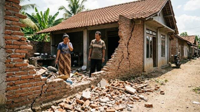
Local disaster management and provincial authorities reported strong shaking in Kodi and neighbouring districts. National and regional emergency agencies said the tremor was felt for approximately one minute in some areas. Preliminary reports to authorities did not immediately show widespread catastrophic destruction, but officials cautioned residents to watch for structural damage, including cracked walls and fallen items, particularly in older buildings.
What officials are asking residents to do
Emergency services and the meteorological agency asked residents in affected areas to inspect homes and public buildings for visible damage, and to avoid damaged structures until engineers can confirm they are safe. Authorities also advised the public to remain alert for aftershocks, to secure heavy objects, and to keep lines of communication open for updates from local disaster agencies.
Why a shallow quake matters
Earthquakes that originate at shallow depths often produce stronger ground shaking at nearby communities than deeper events of the same magnitude. At a depth of 10 kilometres, this earthquake had the potential to generate severe localized shaking even though it occurred offshore. That is why authorities emphasised rapid local inspections and why residents reported feeling strong vibrations despite the epicenter being at sea.
Context for Sumba and Indonesia's seismic risk
Sumba sits within the complex tectonic environment of eastern Indonesia, where the convergence of several plates and fracture zones regularly produces earthquakes. Indonesia has well established monitoring and emergency response systems, backed by a dense network of seismic stations. That network enabled authorities to quickly determine the quake parameters and issue public guidance on tsunami risk and safety precautions.
What happens next
Emergency management teams in East Nusa Tenggara province will continue damage assessments through the day and coordinate any needed humanitarian or infrastructure responses. Authorities will also keep monitoring for aftershocks and provide timely public information. For residents, officials urged caution around damaged buildings, attention to official bulletins, and readiness to follow local evacuation guidance if conditions change.
The quick public statements from national and regional agencies and the absence of an immediate tsunami threat reduced the risk of displacement from coastal evacuations, but emergency services will continue to prioritise safety checks and support where damage is found.
As assessments progress, agencies will provide updates on any injuries, infrastructure damage, or needs for external assistance. For now, the event serves as a reminder of Indonesia's persistent seismic exposure and the value of preparedness and resilient construction in coastal and island communities.